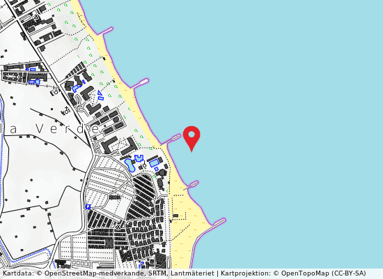
Spiaggia di 500m sx foce adige
- Water temp(satellite):
- 13.6°C
- 2025-04-10
5 km from the city of Venice and boasts a beautiful sandy beach.
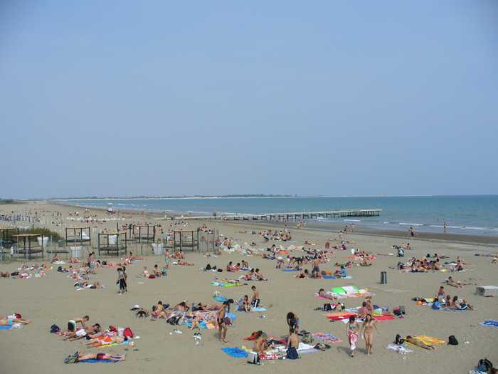
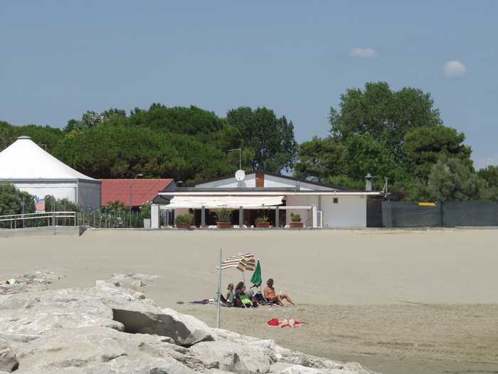
Visitors can enjoy a range of amenities including assistance with first aid, services for the disabled, toilets, refreshments, and sports facilities. The area is also ideal for water sports and boat hire, with clear signs delimiting the regulated area. The Isola Verde coastline spans approximately 2.5 km, stretching from the mouth of the River Brenta in the north to the mouth of the River Adige in the south. The equipped beach is oriented along the northwest to southeast axis and is situated around five kilometers from the center of Venice.
Please help the next visitor by writing a few lines about the beach, are there toilets? Is it shallow? Is there a jetty or maybe a kiosk?
Beaches close to 500m sx foce adige
1150M Sx Foce Adige is a sandy beach located in the province of Venezia. It offers a range of amenities including assistance and first aid services, facilities for the disabled, as well as toilets, refreshment options, and sports facilities. Visitors can also participate in water sports and rent boats, with clear signage indicating the area's regulations and boundaries. The Isola Verde coastline spans approximately 2.5 km and runs from the mouth of the River Brenta in the North to the mouth of the River Adige in the South. The beach is well-equipped and runs on a NW - SE axis, situated roughly 11 km away.
1400M Dx Foce Brenta is a sandy beach located in the province of Venezia. It offers various services such as assistance and first aid, facilities for the disabled, toilets, refreshments, and sports facilities. Additionally, there are opportunities for water sports, boat rentals, and the area is marked with signs for safety. The Isola Verde coastline spans approximately 2.5 km, running from the mouth of the River Brenta to the north and the mouth of the River Adige to the south. The equipped beach is oriented along the northwest to southeast axis and is situated approximately 14 km from the city center.
1100M Foce Brenta is a sandy beach situated in the province of Venezia. The beach offers various amenities such as first aid services, assistance for the disabled, toilets, refreshments, and sports facilities. There are also regulations in place for water sports and boat rentals. The Isola Verde coastline spans from the mouth of the River Brenta in the North to the mouth of the River Adige in the South, covering a length of approximately 2.5 km. The equipped beach is oriented in a northwest to southeast axis and can be found at approximately 11 km from the nearby town.
300M Dx Foce Brenta is a sandy beach located in the province of Venezia, offering various water sports activities. The coastline of Isola Verde spans over 2.5 km from the north mouth of River Brenta to the south mouth of River Adige. The specific stretch of the beach mentioned is free and runs from northwest to southeast, located approximately 3 kilometers away.
300M Depuratore Com. is a beach located in the province of Rovigo. It features a rocky section which has been artificially created to reduce the erosion caused by storm surges. The beach offers assistance and first aid services, and its activities are regulated and delimited. The sandy beach has been reinforced with embankments and faces east. It extends south for about 1-1.5 km from the Adige River mouth and is bordered by pinewoods consisting of maritime pine and holm oak in the alluvial lowland environment of the Po Delta. The beach can be accessed from the right bank road of the Adige River and Rosapineta. A small unpaved road also provides access to the north side of the Adige River mouth and other southern beaches along the coast.
The beach is sandy.Assistance and first-aid services, disability services, bathrooms, snacks, and sports facilities. Lifeguard towers are located at regular intervals along the coast.Water sports are available.The Sottomarina shoreline runs along the peninsula that separates Venices Lagoon from the Adriatic Sea to the south. It stretches for roughly 5 kilometres. The section in question is a well-equipped beach that runs north-south. It is approximately 4.6 kilometres south of the Chioggia inlet and approximately 4.
The beach is located in the province of Rovigo and is characterized as a sandy beach with stretches that are reinforced by man-made embankments. It faces east and extends approximately 2 km south of the mouth of the Adige River. Behind the beach are pinewoods consisting of maritime pine and holm oak, in an alluvial lowland environment of the Po Delta. The beach can be accessed from both Rosapineta (to the north) and Rosolina Mare (to the south) and an unpaved road in the northern part allows visitors to reach the mouth of the Adige. The beach also provides access to the southern bathing spots along the coast.In terms of facilities, the beach offers assistance and first aid services, toilets, refreshment points, sports facilities, and camping. Activities available on the beach include boat hire, and there are signs regulating and delimiting the area.
3800M Diga S.Felice is a sandy beach located in the province of Venezia. It offers various services to beachgoers such as assistance and first-aid services, facilities for the disabled, toilets, refreshments, sports facilities, and lifeguard towers at regular intervals. Visitors can indulge in water sports activities during their visit. The Sottomarina coastline runs along the peninsula that separates the Lagoon of Venice and the Adriatic Sea to the south, stretching for approximately 5 km. The equipped beach is oriented along the N-S axis and is located roughly 3.8 km south of the Chioggia inlet and 1.2 km north of the River Brenta mouth.
This beautiful sandy beach offers a range of facilities and services to make visitors experience as enjoyable and safe as possible. Assistance and first aid services are available, as well as toilets, refreshments, and sports facilities. For those looking to stay longer, there is also a nearby campsite. The beach area is also clearly marked with signs to regulate and delimit the area.The beach faces east and extends approximately 3 km south of the Adige River mouth. Behind the beach, visitors can explore the town of Rosolina Mare, which is surrounded by thick pinewoods and alluvial plains of the Po Delta, and beyond which lies the lagoon and valley areas (Valle Boccavecchia). The beach can be accessed through Viale dei Pini, and the reference point is the piezometric tower. The beach also connects with the northern and southern bathing spots along the coastline.In addition to the natural beauty of the area, visitors can enjoy a range of water sports and boat hire activities. With so much to explore and enjoy, this beach is a must-visit for anyone looking to experience the beauty and excitement of the Italian coastline.
3000M Diga S.Felice is a sandy beach situated in the province of Venezia. It offers a range of amenities, such as assistance and first-aid services, facilities for the disabled, refreshments, toilets, and sports facilities. Additionally, there are regular bathing assistance towers that run along the entire coastline. Visitors can enjoy various activities, including water sports, boat hire, and the use of designated areas marked out for specific purposes.The Sottomarina coastline is approximately five kilometers long and runs along the peninsula separating the Lagoon of Venice and the Adriatic Sea to the south. The equipped beach is oriented along a North-South axis and is situated about three kilometers from the mouth of the port of Chioggia and two kilometers from the mouth of the River Brenta.
